
From scattered data to spatial intelligence
Our geolocation engine turns raw network data into real-time, high-resolution visibility—across every point, place, and path.

Location still matters.
But most tools don’t show it.
Operators still rely on static dashboards or sporadic field tests to understand network quality. But performance varies by street, by building, by second. And traditional tools miss what’s really happening on the ground.
Kenmei’s geolocation engine provides continuous, data-driven insight into how your network performs. Everywhere it matters.
Drive tests are costly and geographically limited
KPI dashboards miss location-specific degradations
Planning decisions are made with incomplete visibility
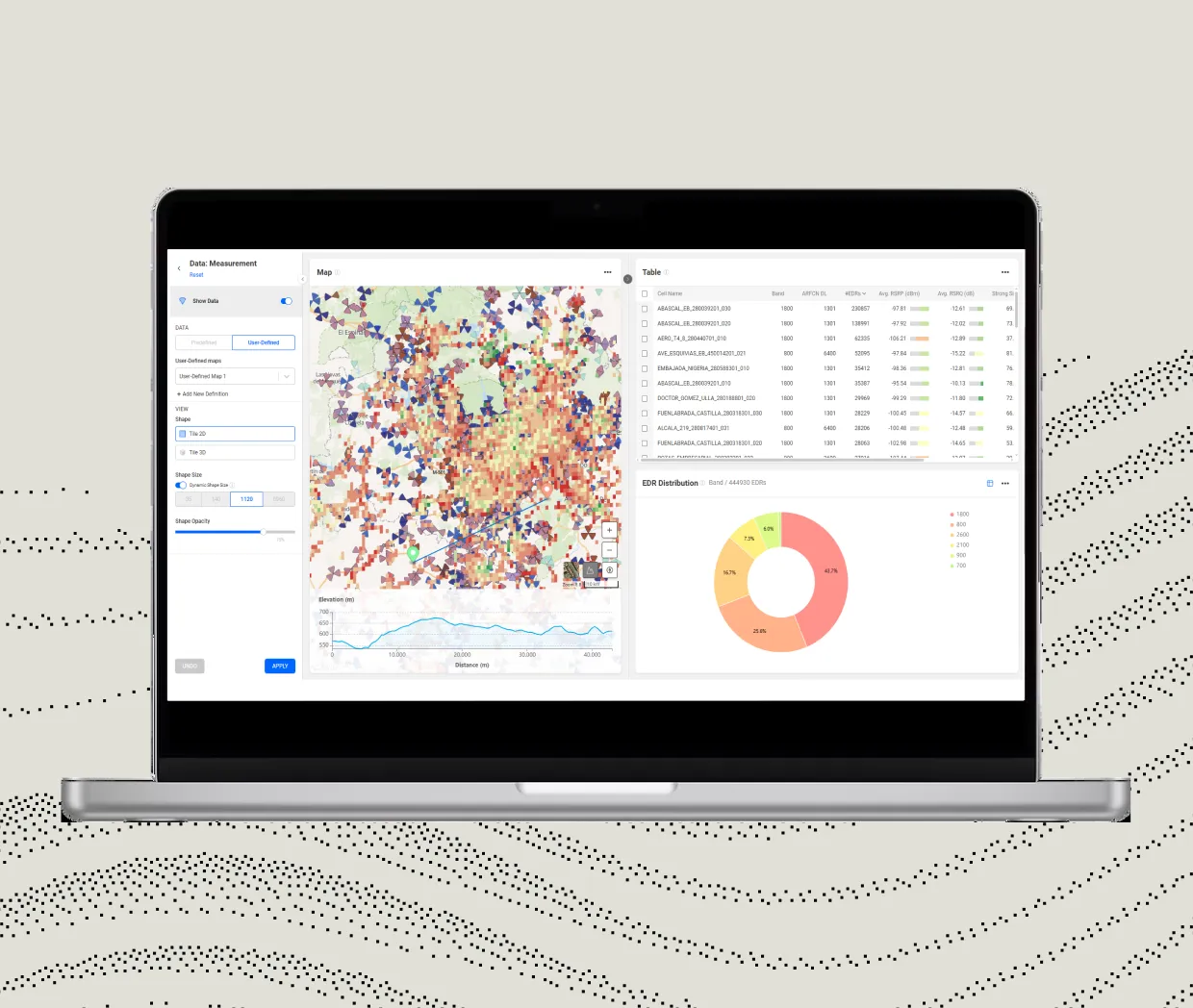
From raw traces to precise maps.
A closer look at how our geolocation engine works
Correlation
Correlates call traces, crowd data, and topology to extract location-based metrics
Localization
Applies advanced algorithms like fingerprinting and trilateration
Segmentation
Segments performance by tile, road, POI, or building
Integration
Integrates GPS, signaling, KPI, and configuration data for full context

Our geolocation engine turns raw network data into real-time, high-resolution visibility—across every point, place, and path.
Key Benefits
Pinpoint performance problems
Visualize exactly where issues are emerging—even when KPIs look normal.
Replace costly drive tests
Use trace data to assess coverage and quality without field teams.
Make smarter planning decisions
Prioritize expansions, optimize roads & railways, and validate new site performance with real data.
“Vodafone unlocked new revenue streams by increasing geolocation accuracy by 50% using our fingerprinting engine.”
Want to see what your maps are missing?
Schedule a walkthrough of our geolocation engine in action.